BTCEB Virtual Gala Rides are here!
In the era of Covid we can’t do our normal Gala rides but we’re reaching out to provide some incentive to get out and ride and give you some possible routes to explore. To that end we bring you A Separately Together Gala Ride. They way it works is we’ll provide three curated rides with increasing difficulty similar to our regular Gala rides (A, B, and C hardest to easiest).
The January 2021 virtual gala ride is at Fernandez Ranch. Fernandez Ranch is much shorter than last month’s ride at Crockett Hills with very low technicality but still offers great views and some fun single track.
The best way to participate in this month’s ride is head over to the BTCEB Strava Club. If. you are not yet a member of our Strava club, please give us a day or so to approve you. Membership in the BTCEB Strava Club is open to the public.
Over on Strava we are testing out some functionality to provide for ride tracking and possible promotional giveaways on future virtual gala rides. To help us get prepped for possible giveaways on future virtual gala rides we ask that if you haven’t already, please allow us to track your progress on your upcoming rides:
For your rides to appear in our club leaderboards on the BTCEB website you will need to provide authorization (aka opt-in) for the BTCEB Strava Club to collect data on your rides. By joining the BTCEB Strava club any other members of the Strava club will be able to see your logged activities. By opting in to BTCEB collecting your rides activities we will be able to also publish them individually or in aggregate on our website or in social media posts. BTCEB will not use your ride activity days for any other purpose.
Even if you don’t want to participate in any of the social media aspects of the Virtual Gala Ride we encourage you to get out and ride any! Everyone should be able to enjoy these rides:
The January 2021 Virtual Gala Ride at Fernandez Ranch features group A, B, and C routes each listed as separate ‘events’. Similar to the format of our regular group Gala Rides the A, B, C designations indicate the difficulty of the rides (hardest to easiest). You can do any or all of the routes. And you can ride them as many times as you wish.
*PLEASE NOTE* For your rides to appear in our club leaderboards on the BTCEB website you will need to provide authorization (aka opt in) for the BTCEB ‘Strava Club’ to collect data on your rides. You can do this by going to https://bit.ly/33NTTXx.
Route details:
===========
Route A 14 miles https://www.strava.com/routes/2779975240063221536
Route B 7 miles https://www.strava.com/routes/2779900154785616354
Route C 6 miles https://www.strava.com/routes/2779901109629499874
Route descriptions and turn by turn instructions provided further down this message.
For navigation on your favorite device you can download .gpx or .tcx files from these routes on Strava. See your device Help for details. Strava paid subscribers can navigate on the phone app.
Ride Overview:
============
The A and B routes start clockwise and head up Black Phoebe Trail towards Whipsnake Trail while the C route ventures counter-clockwise up Windmill before turning on to Woodland. If you are unfamiliar with the park there are suggested stopping points for breaks after longer climbs which also double for fantastic viewpoints. Fernandez Ranch is a fairly small park so it’s hard to really get lost. If in doubt keep going in either the clockwise or anticlockwise direction downhill and you should end up at the bridge to the parking lot.
Segments – Your ride should end up logging one of these Strava segments if you follow the above routes:
Route A https://www.strava.com/segments/26794149
Route B https://www.strava.com/segments/26885996
Route C https://www.strava.com/segments/26865880
For your rides to appear in our club leaderboards on the BTCEB website you will need to provide authorization (aka opt in) for the BTCEB ‘Strava Club’ to collect data on your rides. You can do this by going to https://bit.ly/33NTTXx. By joining the Strava club any other members of the club will be able to see your logged activities. By opting in to BTCEB collecting your rides activities we will be able to also publish them individually or in aggregate on our website or in social media posts. BTCEB will not use your ride activity data for any other purpose.
Ride safely, share the trail, Say Hi!, use a bell and/or call out to other trail users, slow when passing, yield to uphill traffic, hikers, dogs, and equestrians. Yield the trail to oncoming pedestrians; there’s no choice when we’re going the same direction. Maintain social distancing and have a face covering readily available to use when needed–better yet where a mask for the entire ride! And even with all that don’t forget however your ride goes, it’s probably better than whatever else you would have been doing.
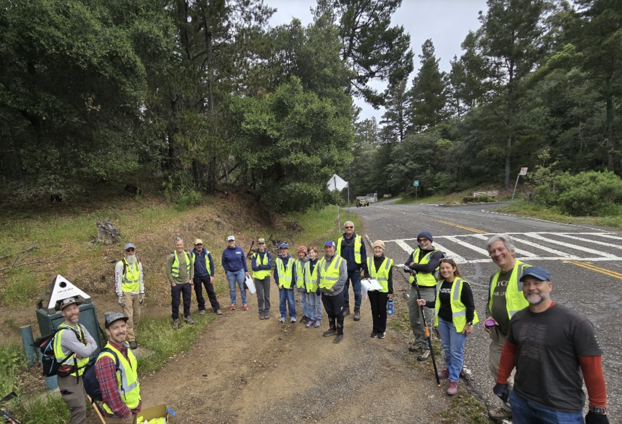
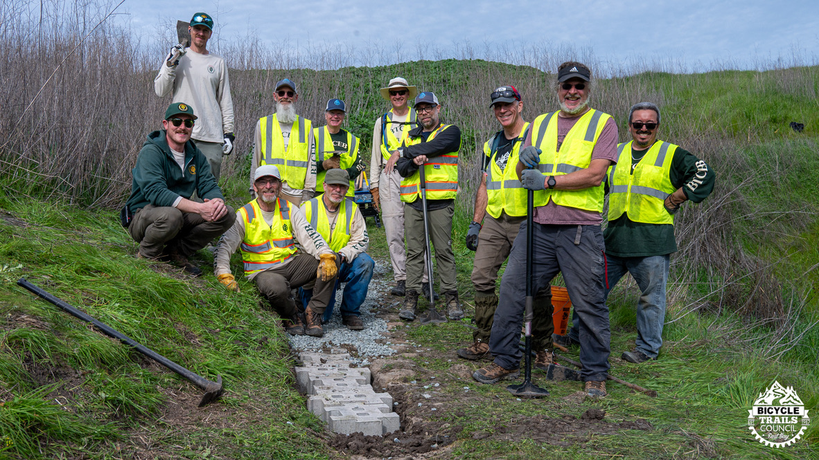
If you’re not already a dues paying member please consider joining the Bicycle Trails Council. BTCEB advocates for more, better, and closer trails, provides support to area middle & high school MTB programs, does trail work in Joaquin Miller, Crockett Hills and other parks, and offers the monthly Ride Like a Girl and Gala Rides. You can join at www.BTCEB.org by clicking the Join button on the home page.
Have a good month, enjoy the routes. Tag @bicycletrailscouncil on Instagram or MTBRider on Facebook with your favorite picture from your ride.
Ride Notes:
==========
All rides start at the Fernandez Ranch parking lot/staging area off of Hwy 4 at 1081 Christie Rd, Martinez, CA 94553
All trails are bi-directional so watch for oncoming traffic.
A Route Turn by Turn (14.4 mi/2,450 ft):
===============================
0 mi. Start by heading across the bridge
0 mi. Turn left on to Black Phoebe Trail. After crossing the bridge turn hard left to ride clockwise around the park.
0.3 mi. Continue through the cattle gate onto Whipsnake Trail for a nice warm up climb.
1.3 mi. Viewpoint. Stop here for a quick break. Look at the view!
1.3 mi. Stay on Whipsnake Trail and enjoy the scenic view as it meanders downhill across an open meadow.
1.6 mi. Continue on Whipsnake Trail as it enters the canopy. Beware of 3 fairly tight downhill switchbacks as you make your way to the bottom of the trail.
2.0 mi. Cross the wooden bridge at the creek
2.0 mi. Continue for about 100 ft up the trail and turn hard left onto Wood Rat Trail which is the single track that ventures South before it quickly veers to the Northwest into more canopy and continues uphill.
2.6 mi. Continue through the EBMUD cattle gate onto Goat Road
2.6 mi. Turn right onto Goat Road fireroad.
3.2 mi. Continue through the EBMUD cattle gate back into the Fernandez Ranch property.
3.2 mi. Continue straight onto Franklin Ridge Trail and start looking for a right turn
3.3 mi. Turn right onto Canyon Loop Trail
3.4 mi. Continue straight through the two cattle gates.
3.5 mi. Continue straight down the rather steep (15-20%) downhill. Stay on the trail as it veers around to the left
3.8 mi. Stay left as you are coming down the trail.
4.1 mi. Continue into the canopy. Be sure to get into your climbing gear as all of that elevation you just lost you are about to earn back.
4.6 mi. Continue straight as you emerge from the canopy and start looking for Vista Trail over to your right. It connects up and heads off to the right just before the dirt road.
4.6 mi. Turn right onto Vista Trail for a short easy switchback climb to the top. Do you still have your legs with you or did you leave them back in the woods on Canyon Loop?
4.8 mi. Viewpoint. At the top make sure you ride all the way out to the end of the single track. Stop again but this time enjoy the view! Take a photo and tag #bicycletrailscouncil on Instagram.
When you are ready head back down the Vista Trail the way you came.
5.0 mi. Turn left onto Franklin Ridge Trail/Canyon Loop fireroad and head back towards those cattle gates that started Canyon Loop.
5.1 mi. Turn left onto Canyon Loop
5.2 mi Continue through the first cattle gate and immediately turn right through the next cattle gate onto Woodland Trail
5.2 mi. Continue down Woodland Trail as it traverses through the canopy. Between here and the end of the Woodland Trail there are 6 small wooden bridges. Can you count them all?
6.1 mi. Continue through the cattle gate and take a quick breather if you need. There’s a great view from here too!
6.7 mi. Stay straight and merge onto Windmill Trail fireroad.
6.8 mi. Turn left onto Whipsnake Trail connector as it briefly meanders through canopy.
6.9 mi. Stay left as the trail splits. Follow the trail down towards the wooden bridge
7.0 mi. Continue straight and cross the bridge. The initial climb up Whipsnake features three moderately tight switchbacks but this is the “A” ride so no sweat, right?
7.3 mi. Continue on Whipsnake. As you emerge from the canopy, continue East winding through the grassy meadow traverse.
7.5 mi. Continue on Whipsnake as veers to the North for the remainder of the climb.
7.7 mi. Viewpoint. As the trail veers to the East/South East stop here for a minute for another wonderous view.
7.7 mi. Continue on Whipsnake and enjoy the fun part!
8.1 mi. Caution. Beware of two of the three fairly tight downhill switchbacks spaced less than 1/10 of a mile apart especially if you are really railing it. Be on the look out for hikers or other bikers!
8.5 mi. Turn hard right and continue on through downhill switchback number three. Whee!
8.5 mi. Veer hard left and go through the gate, cross the wooden bridge, and continue onto Black Phoebe Trail and follow it back to the bridge where you started the ride.
9.0 Turn left to head up the trail that goes behind the picnic tables.
9.1 mi. Stop here at the picnic tables. This is a good spot to recharge. From here you are about two-thirds of the way through the ride.
9.5 mi. Turn right onto Woodland Trail. It’s the only obvious single track that winds it way up the hill to the East. This will be the hardest climb of the day but not that hard 🙂
10.0 mi. Continue through the gate and take a quick breather if you need it. It’s not all downhill from here but it’s more flowing canopy that ends in another climb.
10.9 mi. Viewpoint. Stop at the cattle gates. You’ll go though two gates: immediately turn left after going through the first gate to get through the second gate. This is another nice spot for a really quick break.
10.9 mi. Continue up the gentle hill and as you crest it, start to look for a right turn onto a dirt fireroad.
11.0 mi. Turn left onto Franklin Ridge Trail fireroad
11.1 mi. Continue through the gate to enter EBMUD area
11.2 mi. Stay straight on Goat Rd fireroad.
11.6 mi. Continue to descend the somewhat steep fire road
11.7 mi. Turn left through the cattle gate to exit the EBMUD land/Goat Rd. Immediately veer right onto Woodrat Trail. It’s the single track just to the right of the Windmill Trail which is the fireroad on the left.
Woodrat Trail is a fun downhill single track
12.3 mi. Turn right to merge onto Whipsnake Trail heading down to cross the wooden bridge.
12.4 mi. The initial climb up Whipsnake features three moderately tight switchbacks.
12.6 mi. Continue on Whipsnake. As you emerge from the canopy, continue East winding through the grassy meadow traverse.
12.9 mi. Continue on Whipsnake as veers to the North for the remainder of the climb.
13.0 mi. Viewpoint. As the trail veers to the East/South East stop here for a minute for another wonderous view.
13.0 mi. Continue on Whipsnake and enjoy the fun part!
13.5 mi. Caution. Beware of two of the three fairly tight downhill switchbacks spaced less than 1/10 of mile apart
13.8 mi. Turn hard right and continue on through downhill switchback number three. Whee!
13.9 mi. Veer hard left and go through the gate, cross the wooden bridge, and continue onto Black Phoebe Trail and follow it back to the bridge where you started the ride.
14.3 mi. Turn right on to bridge and continue to parking lot.
B Route Turn by Turn (7.8 mi/1,200 ft):
===============================
0 mi. Start by heading across the bridge
0 mi. Turn left on to Black Phoebe Trail. After crossing the bridge hard left to ride clockwise around the park.
0.3 mi. Continue through the cattle gate onto Whipsnake Trail for a nice warm up climb
1.3 mi. Viewpoint. Stop here for a quick break. Look at the view!
1.3 mi. Stay on Whipsnake Trail and enjoy the scenic view as it meanders downhill across an open meadow
1.6 mi. Continue on Whipsnake Trail as it enters a canopy. Beware of 3 fairly tight downhill switchbacks as you make your way to the bottom of the trail.
1.9 mi. Cross the wooden bridge at the creek
1.9 mi. Continue for about 100 ft up the trail and turn right onto Wood Rat Trail which is the single track that ventures Northwest into more canopy and continues gently downhill back towards the Windmill Trail.
2.1 mi. Turn right and merge onto Windmill Trail
2.3 mi. Turn left at the post onto Woodland Trail where you will climb again for about a 1/2 mile. It might be hard to make out but it’s the only obvious single track that winds it way up the hill to the East.
2.8 mi. Continue through the cattle gate and take a quick breather if you need it. It’s not all downhill from here but it’s more flowing canopy that ends in another climb.
3.7 mi. Viewpoint. Stop at the cattle gates. You’ll go though two gates: immediately turn left after going through the first gate to get through the second gate. This is another nice spot for a really quick break.
3.7 mi. Continue up the gentle hill and as you crest it start to look for a right turn onto a dirt fireroad.
3.7 mi. Turn Right onto Franklin Ridge Trail fireroad
3.9 mi. Turn right onto Vista Trail for a short easy switchback climb to the top.
4.1 mi. Viewpoint. At the top make sure you ride all the way out to the end of the single track. Stop again but this time enjoy the view! Take a photo and tag #bicycletrailscouncil on Instagram.
When you are ready head back down the Vista Trail the way you came.
4.3 mi. Turn left onto Franklin Ridge Trail fireroad and head back towards Woodland Trail
4.5 mi. Stay straight and merge onto Goat Rd fireroad heading south away (away from Woodland Trail)
4.6 mi. Continue through the gate to enter EBMUD area
4.7 mi. Veer left to stay on Goat Rd fireroad.
5.0 mi. Continue to descend the somewhat steep fire road
5.2 mi. Turn left through the cattle gate to exit the EBMUD land/Goat Rd. Immediately veer right onto Woodrat Trail. It’s the single track just to the right of the Windmill Trail which is the fireroad on the left.
Woodrat Trail is a fun downhill single track
5.8 mi. Turn right to merge onto Whipsnake Trail heading down to cross the wooden bridge.
5.8 mi. Info. The initial climb up Whipsnake features three moderately tight switchbacks.
6.1 mi. Continue on Whipsnake. As you emerge from the canopy, continue East winding through the grassy meadow traverse.
6.3 mi. Continue on Whipsnake as veers to the North for the remainder of the climb.
6.5 mi. Viewpoint. As the trail veers to the East/South East stop here for a minute for another wondrous view.
6.5 mi. Continue on Whipsnake and enjoy the fun part!
6.9 mi. Caution. Beware of two of the three fairly tight downhill switchbacks spaced less than 1/10 of mile apart
7.3 mi. Turn hard right and continue on through downhill switchback number three. Whee!
7.3 mi. Veer hard left and go through the gate, cross the wooden bridge, and continue onto Black Phoebe Trail and follow it back to the bridge where you started the ride.
7.8 mi. Turn right on to bridge and continue to parking lot.
C Route Turn by Turn (5.9 mi/922 ft):
===============================
0 mi. Start by heading across the bridge
After crossing the bridge veer a bit to your left to stay mostly straight (but don’t turn hard left) to pick up the Windmill connector that leads behind the picnic area and descends to the cattle gate.
0.1 mi. Continue through the gate and follow Windmill Trail (which appears as a fairly wide fire road). Keep an eye out for an upcoming right turn at a sign post onto single track
0.4 mi Turn right onto Woodland Trail. It’s the only obvious single track that winds it way up the hill to the East. This will be the hardest climb of the day but not that hard 🙂
0.9 mi. Continue through the gate and take a quick breather if you need it. It’s not all downhill from here but it’s more flowing canopy that ends in another climb.
1.8 mi. Stop at the cattle gates. You’ll go though two gates: immediately turn left after going through the first gate to get through the second gate. This is another nice spot for a really quick break.
1.8 mi. Continue up the gentle hill and as you crest it start to look for a right turn onto a dirt fireroad.
1.8 mi. Turn Right onto Franklin Ridge Trail fireroad
2.0 mi. Turn right onto Vista Trail for a short easy switchback climb to the top.
2.2 mi. Viewpoint. At the top make sure you ride all the way out to the end of the single track. Stop again but this time enjoy the view! Take a photo and tag #bicycletrailscouncil on Instagram.
When you are ready head back down the Vista Trail the way you came.
2.4 mi. Turn left onto Franklin Ridge Trail fireroad and head back towards Woodland Trail
2.5 mi. Stay straight and merge onto Goat Rd fireroad heading south away (away from Woodland Trail)
2.6 mi. Proceed through the gate to enter EBMUD area
2.7 mi. Veer left to stay on Goat Rd fireroad.
3.0 mi. Continue to descend the somewhat steep fire road
3.2 mi. Turn left through the cattle gate to exit the EBMUD land/Goat Rd. Immediately veer right onto Woodrat Trail. It’s the single track just to the right of the Windmill Trail which is the fireroad on the left.
Woodrat Trail is a fun downhill single track
3.8 mi. Turn right to merge onto Whipsnake Trail heading down to cross the wooden bridge.
3.9 mi. Info. The initial climb up Whipsnake features three moderately tight switchbacks.
4.1 mi. Continue on Whipsnake. As you emerge from the canopy, continue East winding through the grassy meadow traverse.
4.4 mi. Continue on Whipsnake as veers to the North for the remainder of the climb.
4.5 mi. Viewpoint. As the trail veers to the East/South East stop here for a minute for another wonderous view.
4.5 mi. Continue on Whipsnake and enjoy the fun part!
5.0 mi. Caution. Beware of two of the three fairly tight downhill switchbacks spaced less than 1/10 of mile apart
5.3 mi. Turn hard right and continue on through downhill switchback number three. Whee!
5.4 mi. Veer hard left and go through the gate, cross the wooden bridge, and continue onto Black Phoebe Trail and follow it back to the bridge where you started the ride.
5.9 mi. Turn right on to bridge and continue to parking lot.