What is that? Or How About Some Citizen Science?
Madrone? Manzanita? Marsupial?
Have you ever been out on a ride or a hike, seen a plant, bug, bird or animal, and wondered what it was? Okay, for the sake of argument, let’s just say that you have …. Well, in today’s modern world there are some apps out there that can help you identify the flora and fauna around you, and they can even provide some conservation benefits at the same time. These conservation benefits can help us collect data around the impact of trails on nearby species. Logging observations can help to show whether or not plants and animals are increasing or decreasing around trails and with mountain bike activity. This data certainly wouldn’t be mistaken for a controlled study, but observations that happen to show plants or animals of concern appearing to be doing well over time can help to build a case for fewer restrictions on where trails go or what uses may be allowed. Conversely, there is a potential to indicate needs for more structured scientific study to determine actual causes for a decrease in a species. Of course, there are many factors at work and observations of existence alone don’t tell the whole story whenever there is an increase or decrease in a species. Structured scientific studies are likely needed for a more complete picture, but these basic observations can still provide worthwhile learning.
iNaturalist is an app you can use to identify a variety of plants or animals via photos: you snap a photo, upload it, and the app will suggest an identification. Additionally, other users can review the app’s identifications and make their own suggestions. Along the way, you can start to learn more about the flora and fauna along the trails you enjoy.
Merlin is a bird-focused app that provides identifications based on either images or sound recordings. Both iNaturalist and Merlin are fairly straightforward apps to use and are free to download and use.

Here’s an example: at Crockett Hills, we are interested in re-routing a trail to avoid a steep section of fire road. Park district staff are concerned about a specific plant, the Western Leatherwood. It turns out that iNaturalist has several observations over time of Western Leatherwood with images that show Western Leatherwood plants thriving over time right next to existing trails. They are so close to the trail that, if they were poison oak, most of us would be breaking out in a rash! So we’re looking to share these observations with park district staff to have a discussion about their concerns about re-routing this trail in light of this real-world history. We’ll see how that goes.
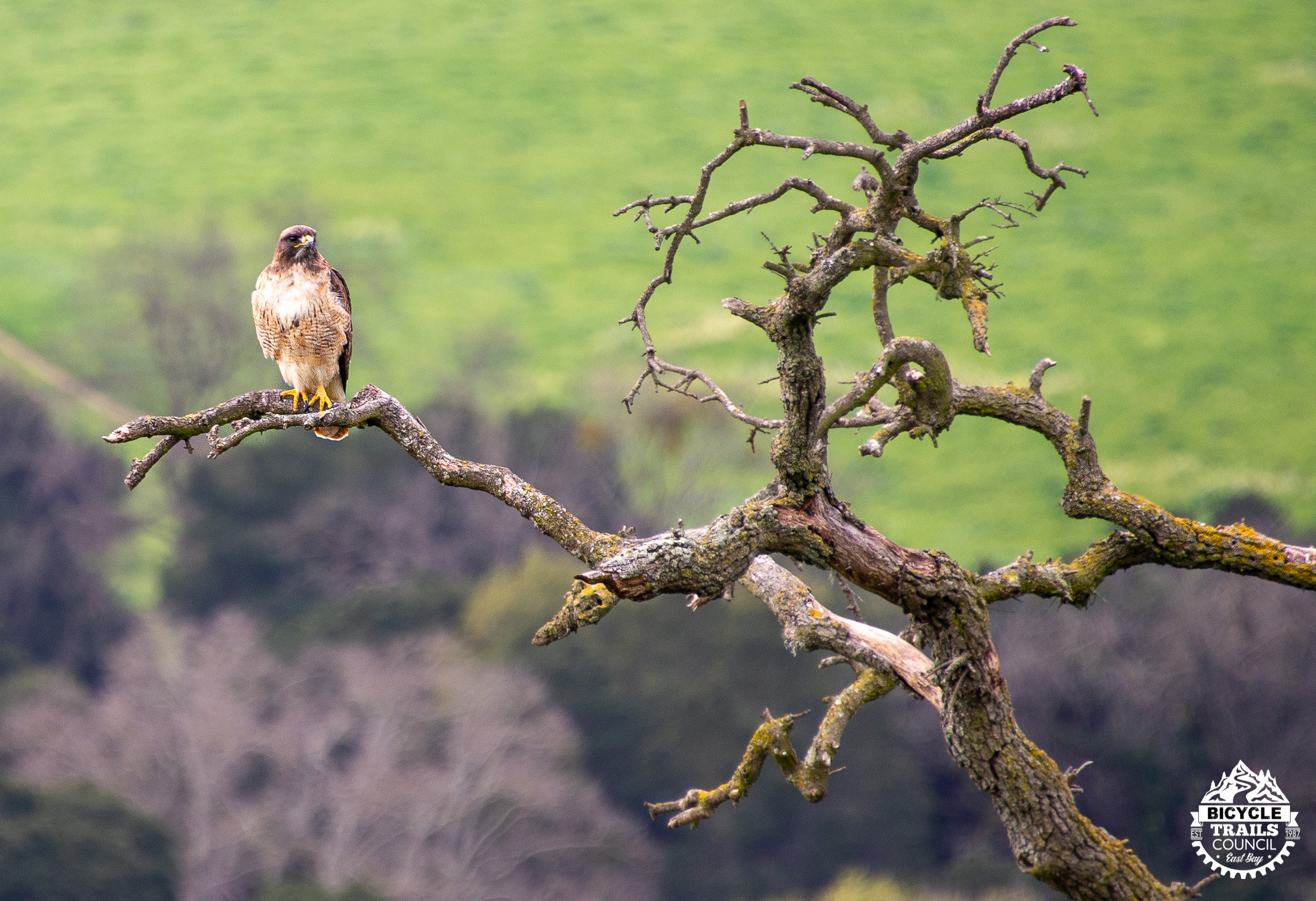
We’re also using it to add documentation of the Golden Eagles that nest in Crockett Hills. The park district watches this much closer than these observations but it doesn’t hurt to back them up, and it’s also an opportunity to make more observations than park staff or contractors can make since trail users are, in most cases, out there a lot more frequently than park staff.
So consider giving this type of app a whirl. There are more of them out than just iNaturalist and Merlin, too. At the very least, you’ll find out the name for that plant or animal you were wondering about, and you just might contribute data that supports more trails and access for bikes. CAUTION: flora and fauna identification can be habit forming — and even addictive — to some of us. Check out the documentary Listers for an educational and entertaining look into extreme birding. Then again, maybe that’s exactly how you want to spend 2026 ….
Scott Bartlebaugh, Advocacy Director
Photos by Rebecca Lewington